Blue Ridge Parkway – Map, Best Stops & Best Time to Drive
There’s something timeless about the Blue Ridge Parkway, often called America’s Favorite Drive. Stretching 469 miles through Virginia and North Carolina, the parkway connects Shenandoah National Park with the Great Smoky Mountains, winding past misty ridgelines, mountain overlooks, and rolling Appalachian farmland.
Whether you’re here for a short weekend escape or the full end-to-end journey, the Blue Ridge Parkway offers one of the most scenic drives in the United States, blending natural beauty, cultural heritage, and a pace of travel that feels like stepping back in time.
Best Time to Drive the Blue Ridge Parkway
While the Blue Ridge Parkway is open year-round, the experience changes dramatically with the seasons:
- Spring (April–June) – Blooming rhododendrons and dogwoods line the roadside, and waterfalls run full with spring melt.
- Summer (July–August) – Warm days and cool mountain breezes make for perfect picnics and hiking, though expect more visitors.
- Fall (September–October) – The most famous season on the Parkway — fiery foliage, crisp air, and endless photo opportunities.
- Winter (November–March) – Peaceful, uncrowded, and atmospheric, but be prepared for road closures due to snow or ice.
💡 Tip: Before setting off, check our live weather feature to see real-time conditions. On mountain roads, sunshine in the valleys can mean fog or frost higher up the Parkway.
Blue Ridge Parkway Attractions
From mountaintop views to cultural landmarks, here are a few highlights you won’t want to miss:
- Skyline Drive to Rockfish Gap (Mile 0)
Begin where Shenandoah National Park meets the Parkway. - Mabry Mill (Mile 176)
One of the most photographed spots on the Parkway — a historic watermill with working demonstrations. - Blue Ridge Music Center (Mile 213)
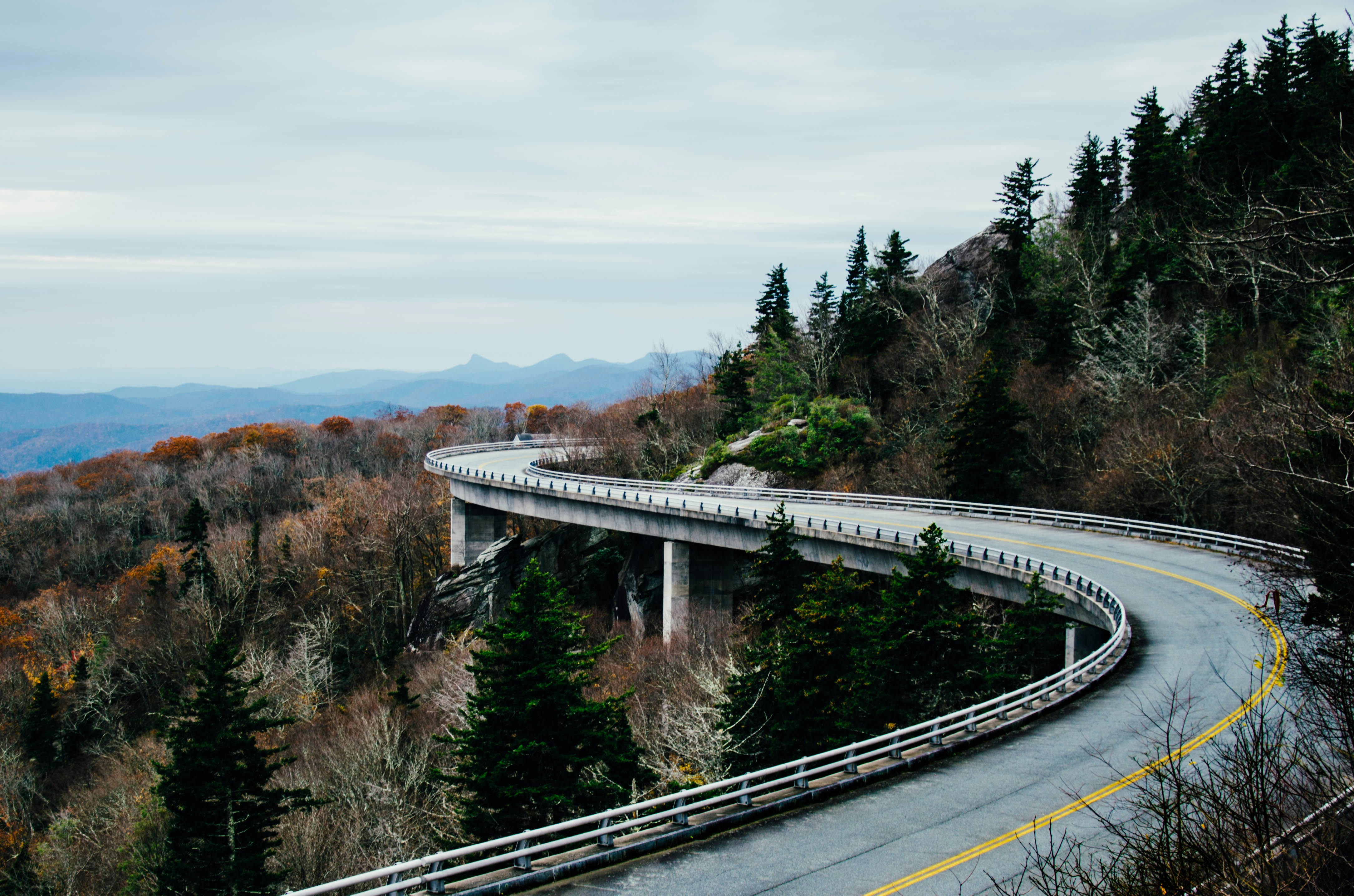
Celebrate Appalachian heritage with live bluegrass and folk performances. - Linn Cove Viaduct (Mile 304)
An engineering marvel, this curved bridge seems to float along the mountainside. - Craggy Gardens (Mile 364)
Famous for rhododendron blooms and panoramic hiking trails. - Clingmans Dome (via Smoky Mountains)
At 6,643 feet, the highest point in the Great Smoky Mountains National Park, with sweeping 360° views.
3-Day Blue Ridge Parkway Itinerary
Day 1: Rockfish Gap → Roanoke
- Start at the northern entrance near Shenandoah.
- Stop at Humpback Rocks for a short hike and stunning views.
- Overnight in Roanoke, a lively mountain town.
Day 2: Roanoke → Asheville
- Visit Mabry Mill and the Blue Ridge Music Center.
- Drive across the Linn Cove Viaduct near Grandfather Mountain.
- Overnight in Asheville, known for its vibrant arts and food scene.
Day 3: Asheville → Great Smoky Mountains
- Stop at Craggy Gardens for a morning hike.
- Continue south to the Smokies and finish with a climb to Clingmans Dome.
Planning Tips
- Fuel & Facilities: Gas stations are located in nearby towns but not directly on the Parkway. Plan stops ahead.
- Timing: Speed limits are low (35–45 mph), so allow extra time for sightseeing and pull-offs.
- Events: Check local calendars for fall festivals, music gatherings, and craft fairs in nearby communities.
Blue Ridge Parkway Weather
The Parkway spans elevations from under 700 feet to over 6,000 feet, meaning conditions can change quickly. A warm day in Asheville might mean fog on the Viaduct or frost near Craggy Gardens.
Our Forecast Slider lets you preview weather along the exact route, mile by mile — helping you avoid storms and time your drive for the clearest views.
FAQs
How long does it take to drive the Blue Ridge Parkway?
Driving end-to-end takes about 12–14 hours without stops. Most travelers spread the journey over 3–7 days.
When is the best time to drive the Blue Ridge Parkway?
October is the most popular month, thanks to spectacular fall foliage. For fewer crowds, try late spring or early summer.
Plan Your Blue Ridge Parkway Trip
Bring your Blue Ridge Parkway journey to life with our app, complete with live weather updates, route planning, and must-see stop recommendations.


